
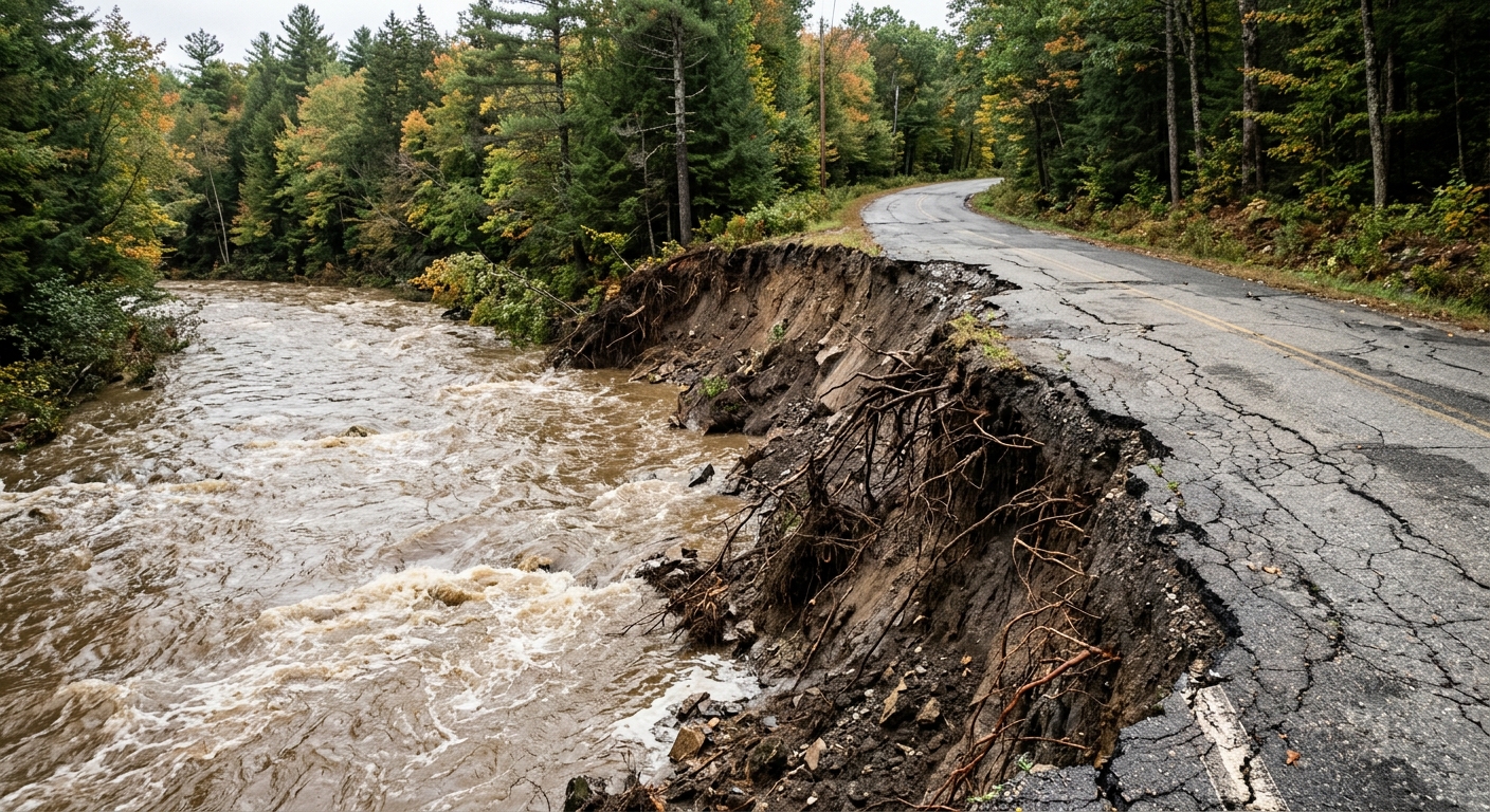
AI-generated illustration; not a photograph of the reported event.
- calendar_today November 9, 2026
Communities on the Front Line of River Erosion
Julie Rapczynski never expected the distant, quiet Nasmith Brook to threaten her home in Marshfield. But July 10, 2023 brought intense rain, landslides, and a new river path through her backyard. A year later, another storm eroded the bank beneath her deck and endangered her family’s electrical lines. By August 2024, Green Mountain Power warned electricity would be cut as the river crept closer. Ultimately, Julie and her husband, Ray, were forced to leave their home of five years.
This story is not unique. River erosion has become the greatest naturally occurring threat to Vermonters, state officials say, accounting for most of the over $800 million in flood damage caused by recent storms. Vermont's rivers—already unstable, given the region's terrain—have become more destructive as heavy rains push water into homes, roads, and entire communities.
Historical Attempts to Control Vermont’s Rivers
With over 7,000 miles of rivers flowing through towns and cities that depended on water for power and transportation, Vermont’s early approach to flood management emphasized controlling rivers through dams, dredging, and channel straightening. This kept water away from roads and infrastructure but ultimately disconnected about 75% of state rivers from their floodplains, making erosion during storms more likely.
State policy shifted in the late 1990s, aiming to restore floodplains and give rivers more space. However, many large restoration projects failed when the rivers behaved unpredictably. Today, Vermont prioritizes protecting river corridors and allowing rivers to follow natural, meandering paths. As Rob Evans from the Department of Environmental Conservation notes, “The river is going to take that space. It’s just a matter of when.”
Limited Options for Flood Survivors
Many Vermont homes, like the Rapczynskis’ and thousands of others, sit outside FEMA-mapped flood zones. FEMA’s maps often overlook small streams and generally do not account for erosion risk, making it harder for some at-risk property owners to qualify for federal buyouts or mitigation programs. More than 21,000 buildings lie within Vermont’s river corridors where erosion is a pressing danger.
In 2021, Vermont established the Flood Resilient Communities Fund for state-funded buyouts of threatened homes. Supported by federal and state dollars, the fund purchased 52 properties, including the Rapczynskis’. Buyouts can free homeowners financially and remove properties from repeatedly flooded zones, but with limited funds—$3.5 million set aside in 2024—demand far outpaces available support. Ongoing funding remains uncertain, prompting calls for a robust, dedicated state program.
Facing Immediate and Long-Term Risks
River erosion can unfold over years or cascade within hours, as witnessed during the flash floods of July 2024 in Lyndon and Plainfield. Nearly eight inches of rain in Lyndon demolished several homes, swept away roads, and displaced families. In Plainfield, the destruction of Brook Road left the town weighing whether to rebuild at a potential cost far beyond its annual budget.
Temporary fixes, such as riprap walls supported by the U.S. Department of Agriculture’s Emergency Watershed Protection Program, have proved both essential and fragile. Studies indicate that at least 8% of such emergency projects failed within two years, and repeated costly repairs are not guaranteed under federal support guidelines.
Regulation, Science, and Uncertainty
As Vermont’s 2024 Flood Safety Act approaches implementation, new homes and buildings in river corridors will soon require state permits, reflecting the push to limit future risk. Still, protecting existing homes is complex. Residents seeking stream bank stabilization or dredging permits face high costs, scientific challenges, and policies designed to let rivers regain natural stability—sometimes at odds with property owners’ immediate needs.
Town officials and flood survivors continue to advocate for more resources and better understanding from both state and federal programs. FEMA is expected to update Vermont’s flood maps by 2030, though they are still unlikely to incorporate erosion risk comprehensively.
A Future in Flux for Riverfront Communities
Many affected residents, like Amy Seoane of Huntington, face difficult decisions about whether to accept buyouts, elevate their homes, or remain as erosion risk intensifies. Buyout offers sometimes come too late, and the state’s housing shortage adds to families’ reluctance to leave. Experts acknowledge that Vermont’s mitigation has been largely reactive, with limited proactive planning for the next major flood threat.
As Vermont’s annual rainfall continues to rise and the impacts of climate change become more severe, the challenge of river erosion will persist. State officials, local leaders, and affected communities agree: there is no simple fix, and navigating the balance between scientific best practices, community needs, and available resources will require sustained commitment and innovative approaches for years to come.
Source: vtdigger.org.


